Tracking
Live map
Track your whole fleet on the live map in real time - see where every vehicle is now, follow it, tune the map and watch the live alert feed.
Walkthrough The live map2 screenshots
- Your whole fleet, live on one map
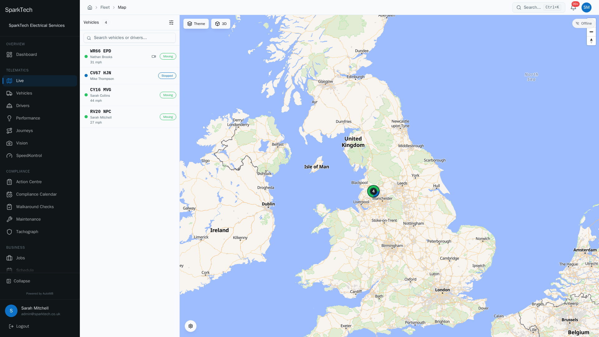
Open Telematics then Live. Every tracked vehicle appears on the map with its driver and status, and the side panel lists them all.
- Follow a single vehicle
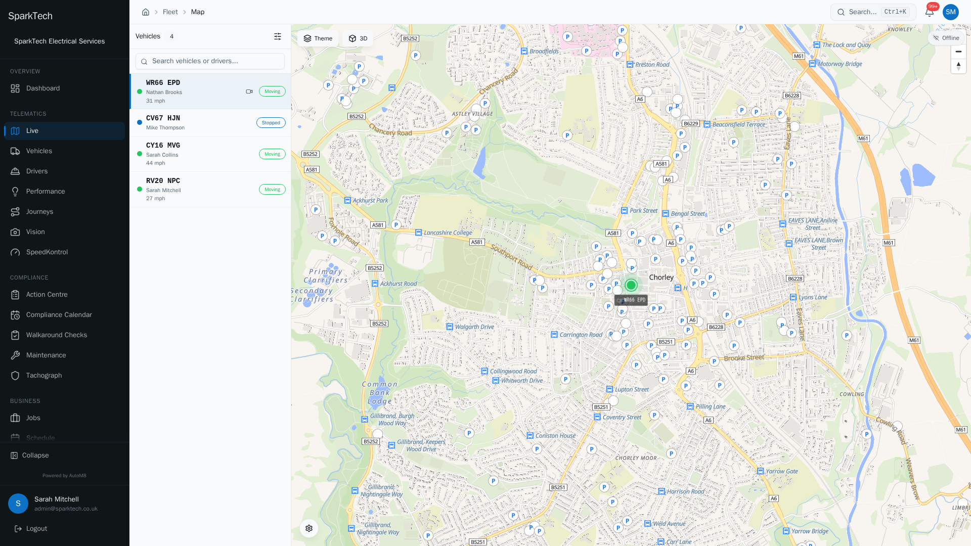
Select a vehicle to fly to it on the map and see its live position, speed and the driver behind the wheel.
The live map shows where every vehicle in your fleet is, in real time. It updates on its own as vehicles report in - you do not need to refresh.
Permissions. Seeing the live map needs the Live Map View permission (in the FMS (Fleet Management) group). Your geofences only appear on the map if you also have Geofences View. Administrator and Manager include these by default.
Opening the live map
Go to Telematics (the tracking section of the left-hand menu) > Live.
What you see
Who can do this: anyone with the Live Map View permission.
- Vehicle markers showing each vehicle’s registration, the way it is pointing, its speed, the driver and its current address. A moving vehicle pulses; an idle one glows; a stopped one is a plain dot.
- A status for each vehicle - Moving (green), Idle (amber), Stopped (blue). A vehicle with no active licence shows as Frozen (greyed out and static); see Vehicle licences.
- A live connection indicator (top right) reading Live or Offline, so you know positions are updating.
- A vehicle list alongside the map (left on desktop, below on mobile) that you can search and filter.
- Your geofences drawn on the map, if you have permission to see them.
- A camera badge on any vehicle fitted with a camera.
Following a vehicle
Who can do this: anyone with the Live Map View permission.
- Select a vehicle (on the map or in the list) to see its details and, where fitted, its current speed limit.
- Double-click a vehicle to open its full detail page.
- Right-click a vehicle for quick actions: View Vehicle, View Device or Centre Map.
- Turn on Auto-follow (in Map Settings) to keep the selected vehicle centred as it moves.
Map Settings
Who can do this: anyone with the Live Map View permission.
Open the cog button at the bottom-left of the map. Your choices are remembered on this device.
| Toggle | What it does |
|---|---|
| Vehicle labels | Show or hide the registration label under each marker. |
| Cluster markers | Group nearby vehicles into a single count that splits apart as you zoom in. |
| Geofence overlays | Draw your geofences on the map (only shown if you have Geofences View). |
| Auto-follow | Keep the selected vehicle centred as it moves. |
| Show idle vehicles | Treat ignition-on but not-moving vehicles as a separate Idle (amber) status rather than folding them into Stopped. |
| Show last reported | Show how long ago each vehicle last reported (for example “5 minutes ago”) in the list. |
| Show cameras | Show the camera badge on camera-equipped vehicles and the camera icon in the list. |
| Show frozen vehicles | Show vehicles with no active licence (greyed out). On by default; turn it off to hide them. |
There is also a Fullscreen control in the same panel.
The vehicle list
Who can do this: anyone with the Live Map View permission.
The list beside the map has its own search (by registration, make, model or driver) and a filter dialog (the sliders icon):
- Status - All, Moving, Idle, Stopped or Offline.
- Driver - all drivers, unassigned, or one named driver.
- Sort by - Last Updated, Speed or Registration.
- Group by - none, or grouped by Status.
A dot next to the filter icon shows when a filter is active; Clear resets them all. Each row shows the vehicle, its driver, its speed and its status badge, and a camera icon you can tap to open the live stream.
Emergency vehicle indicators
On fleets set up with emergency-vehicle inputs, the map and list flag live safety states so they cannot be missed:
- Panic - a red pulsing ring on the marker and a red Panic badge, when the panic button is pressed.
- Section 19 (blue lights) - a blue pulsing ring and a blue Section 19 badge, when the blue lights are on. Section 19 is the legal exemption that lets emergency vehicles use blue lights.
- A vehicle can show both at once.
- In the list, an active state shows as an animated coloured bar on the right edge of the row (red for panic, blue for Section 19, a blue/white/red cycle for both).
Siren and PTO (power take-off) activity are recorded as events; see Driving events.
These indicators only appear for vehicles whose wired inputs have been given the matching role. See Fleet settings.
Live alerts
Who can do this: anyone with the Live Map View permission.
As alerts come in (geofence entry/exit, tampering, driving events and more) they pop up as short on-screen messages. Which events raise an alert, and who is notified, is set under Settings > Fleet; see Fleet settings. You can turn on an alert sound so you hear each one; the setting is per device.
Cameras on the map
A vehicle fitted with a camera shows a camera badge. Select it and open its live stream straight from the map. See Cameras and video.
Troubleshooting
Why is a vehicle missing from the map? It is usually one of two things: the vehicle is outside your visibility scope (you can only see the vehicle groups your role allows), or it has no device fitted, or its device is offline and has not reported. Check the vehicle list filter is not hiding it (for example the Status filter set to Moving), and check the device on Managing devices and trackers.
Why is a vehicle greyed out and not moving? A greyed-out, static marker means the vehicle is Frozen - it has no active licence, so live tracking is paused. See Vehicle licences. You can hide frozen vehicles with the Show frozen vehicles toggle in Map Settings.
Why is there no live position for a vehicle? The vehicle needs a device that is assigned to it and reporting. If the device is not assigned to the vehicle, or is not currently sending positions, no live marker appears. Check the device is assigned and online on Managing devices and trackers.
For permission, scope or licence causes, see Troubleshooting.
Related
- Journeys and replay.
- Driving events.
- Geofences.
- Cameras and video.
- Fleet settings.
- The live map is the front door to AutoM8 vehicle tracking.